Back
Geography home page
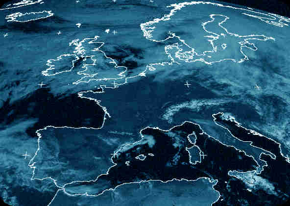
 Seen
from space, the part of the globe that is occupied by Europe has almost equal
areas of land and water. The sea surrounds us on three sides and cleaves deeply
into the Baltic region, the British Isles and the Adriatic. The influence of
this mass of water is to reduce the severity of the climate by comparison with
the bulk of the Eurasian landmass to the east.
Europe is a geographically
diverse area including some of the world's oldest known rock, located in the
Scandinavian peninsula to the north. Younger regions include the mountains of
the Alps and the Pyrenees, which tower to over 4,500 metres. An extremely fertile
area, spreading from Great Britain across to France and the Black Sea, known
as the North European Plain, is of middle age. Major rivers originating in the
mountain regions bisect the lowland plains as they flow to the sea: the Rhine
to the north, Danube to the south-east and the Loire and Dordogne to the east.
The fertile deposits which they bring can be harnessed for agriculture, while
the actual rivers are valuable for water power, transport and wildlife.
Picture source: www.ccc.nottingham.ac.uk/pub/sat-images/
 Seen
from space, the part of the globe that is occupied by Europe has almost equal
areas of land and water. The sea surrounds us on three sides and cleaves deeply
into the Baltic region, the British Isles and the Adriatic. The influence of
this mass of water is to reduce the severity of the climate by comparison with
the bulk of the Eurasian landmass to the east.